Our Company
The Karuwa Seti Hydropower Project (KSHP) is a run-of-river hydropower project proposed along the Seti khola in Kaski District, of Gandaki Zone. Jhyamolongma Hydropower Development Company Private Limited (JHDC) holds the survey license for this project
JHYAMOLONGMA Hydropower JHYAMOLONGMA Hydropower
jhyamolongma hydropower development company private limited (JHDC)
About The Project
The Karuwa Seti Hydropower Project (KSHP) is a run-of-river hydropower project located along the Seti Khola in the Kaski District of Gandaki Province, Nepal. The project site falls within the Sardi Khola Village Development Committee (VDC), with geographical boundaries extending from 83° 57′ 50″ E to 83° 59′ 30″ E longitude and 28° 22′ 12″ N to 28° 24′ 30″ N latitude. The project is being developed by Jhyamolongma Hydropower Development Company Pvt. Ltd. (JHDC), which was granted the survey license on 26th Mangsir 2073 (11th December 2016) by the Department of Electricity Development (DoED). Initially, JHDC carried out a feasibility study through its internal engineering team. Later, in May 2017, the company appointed Jade Consult Pvt. Ltd. (JADE) to update the feasibility study and undertake the detailed engineering design and tender documentation for the project.
The project headworks is situated approximately 16 km north of Lamachaur, which lies in Ward No. 16 of Pokhara Sub-Metropolitan City. Pokhara, the regional hub of the western development region, is around 200 km northwest of Kathmandu. The project area is accessible via a 19 km blacktopped road from Lamachaur to Kharpani in Sardi Khola VDC. The proposed powerhouse site is located just 1.5 km upstream from Kharpani, making it relatively easy to access during construction and operation.
The Seti Khola originates from the Annapurna and Machhapuchhre Himal ranges and flows through snow-covered highlands and dense forests. The catchment area upstream of the proposed intake is approximately 215.87 square kilometers, out of which about 133.57 square kilometers lie at elevations between 3000 to 5000 meters above sea level (masl). To estimate the design discharge, the linear catchment correlation method was employed, utilizing daily discharge data from 2000 to 2004 recorded at the Ghachowk Station (Station 647) by the Nepal Irrigation Sector Project (NISP). This historical hydrological data has been critical for calculating the mean monthly flow at the intake and forms the basis of the project’s design flow and capacity.
TECHNICALS
A detailed topographical survey has been completed for the Karuwa Seti Hydropower Project, and a gauge station has been established on the right bank of the Seti Khola near the proposed intake area. Daily water level readings are conducted three times a day to monitor flow conditions. Geologically, the project area is characterized by formations from both the Lesser Himalaya and the Higher Himalaya, predominantly consisting of garnet schist with occasional bands of banded gneiss. To understand the subsurface geological conditions, surface geological mapping, test pits, and core drilling surveys have already been carried out. These investigations informed the initial layout of the project infrastructure. However, due to significant revisions in the project alignment, additional geotechnical investigations are required for further optimization and confirmation.
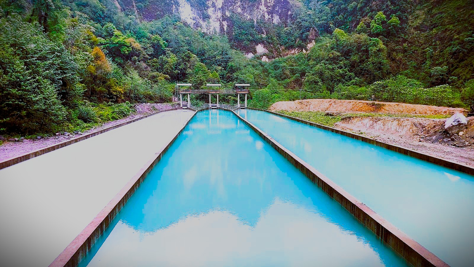
Following a comparison of various alternatives for the headworks and water conveyance systems, the project’s design discharge has been finalized at 15.3 m³/s, with an installed capacity of 32 MW. The project follows a run-of-river configuration, with the headworks located along the right bank of the Seti Khola. The proposed headworks includes a 45-meter-long modified broad-crested weir with a crest elevation of 1531 meters above sea level. Water is diverted through three intake orifices, each measuring 4.7 meters wide and 1.75 meters high, capable of channeling a total discharge of 18.36 m³/s, which includes provisions for sediment flushing.
TTo manage sediment, the project includes a 92-meter-long three-chamber desander, each chamber 9.5 meters wide, designed to remove particles as small as 0.15 mm, protecting the turbine from wear caused by a 248.45-meter water head. Water then flows through a system comprising a headpond, headrace culvert, and a 3.4-meter diameter, 2283.5-meter-long inverted D-shaped tunnel built through schist and gneiss rock. The tunnel leads to a 6-meter diameter, 35-meter-high surge shaft, followed by an 838-meter surface penstock with a 2.2-meter diameter, which delivers the flow to the turbine runner.
The regulated flow enters a semi-surface powerhouse measuring 49.25 m x 11.9 m x 18.0 m, housing three horizontal axis Francis turbines for electricity generation. The water is then discharged into the Seti Khola via a 185-meter tailrace canal. Power generated will be evacuated through a 132 kV single-circuit transmission line, approximately 9.3 km long, connecting the project’s switchyard to the under-construction Lahachowk substation near Pokhara. The route mainly passes through forests and some cultivated or residential land.
The project’s Environmental Impact Assessment (EIA) has been approved, confirming minimal environmental and social impact. A detailed cost estimate based on engineering drawings includes civil works, equipment, transmission infrastructure, and development costs. The total project cost is estimated at NPR 5,155.70 million (excluding IDC), translating to NPR 161 million per MW. Including IDC, the cost rises to NPR 5,805.82 million, or NPR 181 million per MW. Financial analysis, based on an average tariff of NPR 5.34/kWh, shows an Internal Rate of Return (IRR) of 12.86% and a Return on Equity (ROE) of 16.2%, indicating strong financial feasibility. The study concludes that the project is both technically and financially viable. It recommends proceeding with financial closure, full-scale access road construction, and completing additional geotechnical investigations, while continuing to update hydrological data for future assessments.